OUR ITINERARIES
FLY FISHING IN ITALY VAL CAMONICA - DISCOVERING SANT’ANTONIO NATURE RESERVE
The Sant’Antonio Valleys are in the Municipality of Corteno Golgi in the province of Brescia and represent the westernmost edge of the Bergamo Alps which straddle Valtellina and Valle Camonica.
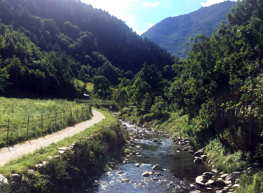
Places of water, stone and wood. There are two main colours which immediately strike anyone making their way up the valleys: green of the lush slopes and white of the mountain streams whose impetuous, crystalline waters furrow the rock as they rush down to the valley floor. Two nature protection organisations, a Regional Nature Reserve and a Natura 2000 Network Special Conservation Zone are designed to safeguard the area’s biodiversity and landscapes.

The Sant’Antonio Valleys Fishing Reserve lies fully within the boundaries of the protected area and this affords it very high-level environmental quality standards. Extending between the Ogliolo stream at 715 m above sea level and Picol Lake (2384 m) along north-facing valleys, it enjoys a typically Alpine climate.
There are a plethora of streams running quickly down towards the valley bottom, where they slow down and meander through pastures and meadows. The clear, cold well-oxygenated waters of the Brandet Valley, Campovecchio Valley and Sant’Antonio Valley streams, fed by melting snows, provide the perfect habitat for Brown Trout.
The Fishing Reserve also includes a natural lake of glacial origin at a height of 2384 m in upper Val Brandet; the lake is 65 m deep and has a good population of Brook Trout. The area is crisscrossed by a network of farming and forestry roads and extremely well-managed hiking trails. Other factors making it easy to enjoy the area and providing easy access to all the fishing areas include two mountain refuges, (Val Brandet and Alpini di Campovecchio mountain refuge) and numerous hotels.
As well as fishing, the valleys offer a plethora of hiking opportunities for mountain lovers as well as trails for fans of mountain bikes. The well-equipped areas along the valley bottom allow you to enjoy your free time in close contact with nature. Breathe in the inimitable uniqueness of these places. You’ll be left in awe at the silhouettes of the peaks over the lakes, the roar of a mountain stream and the musty scent of the woods; it’s almost like a spiritual journey to find yourself.
val camonica in a nutshell

80 km long valley
The largest of the Brescia valleys extends for approximately 80 km from Iseo Lake all the way up to Tonale pass

Fishing for Brook Trout
One of the most important natural areas for catching Brook Trout in Italy

Rock engravings
A UNESCO World Heritage Site since 1979, the rock engravings are Val Camonica’s main attraction

Hundreds of hikes
Bewitching routes through conifer woodlands amongst lakes and mountain streams where you can breathe in nature’s magic
A partial nature reserve of great landscape interest
Located at the easternmost edge of the Bergamo Alps, the Reserve protects two splendid twin valleys, Val Brandet and Campovecchio Valley. Separated by a long ridge, the valleys meet in the quaint village of S. Antonio, perched between two marvellous streams. This village reached its greatest splendour at the turn of the XIX century, a period which saw increased interest in using minerals and forestry and agricultural resources.
The boundaries of the Sant’Antonio Valleys Regional Nature Reserve encompass areas near the Campovecchio and Brandet streams until their confluence next to the village of Sant’Antonio. From here the boundaries descend to the village of Les, remaining approximately 150 m from the river bed on both the left and right banks. The rural settlements of Campovecchio and Brandet as well as the hamlet of Santo’Antonio are also included.

Upstream, the Nature Reserve skirts the Malga Casazza pastures in Val Brandet and the Malga Enet pastures in Campovecchio Valley, covering a total area of approximately 239 ha. In accordance with regulations in force in the Reserve and rules of behaviour governing use of the area, reference should be made to the “Nature Reserve Plan” as well as local signage.
The “Sant’Antonio Valleys” Nature Reserve lies fully within the boundaries of the Site of Community Importance (SCI code Natura 2000: IT2070017), which covers the entire Sant’Antonio Valleys catchment area with a surface area of 4160 ha.
In terms of altitude, we range from 1000 m above sea level near the confluence of the Sant’Antonio Valley with the Ogliolo River (the settlement of Fucine) arriving at the highest peaks with the Torsolazzo (2604 m), Lorio (2674 m), Telenek (2748 m), Sellero (2733 m), Culvegla (2613 m) and Borga (2734 m) mountains demarcating the Campovecchio Valley drainage basin and the Torsoleto (2705 m), Piz Svolt (2641 m), Palone del Torsolazzo (2670 m), ZingloBernu` (2597 m), Palone del Soppressà (2588 m) and Palone di Bondone (2535 m) mountains demarcating the Valle Brandet drainage basin.
WHAT YOU CAN EXPECT TO CATCH IN VALTELLINA
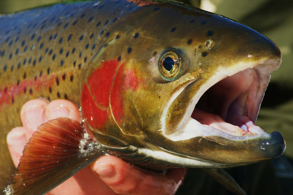
The focus of fishing in Valtellina is primarily grayling (a fish which favours clear rivers and streams, with well-oxygenated water) and brown trout, followed by arctic char and marble trout. The latter can grow quite large and is a typical variety which only lives in the Italian and Slovenian subalpine river basins flowing into the Adriatic.
GRAYLING
(Thymallus Thymallus)
BROWN TROUT
(Salmo Trutta)
ARCTIC CHAR
(Salvelinus Fontinalis)
MARBLE TROUT
(Salmo Marmoratus)


